
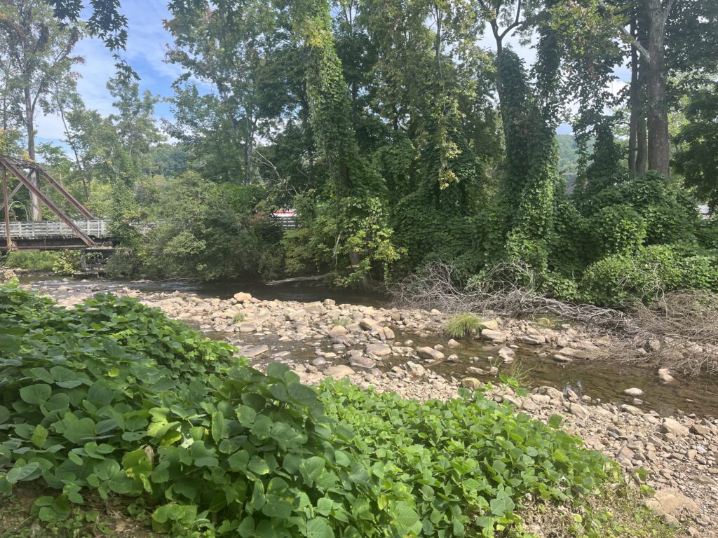
Laurel Creek in Damascus, VA. (Photo by Shannon Heckt/Virginia Mercury)
On September 27th, 2024, floodwaters from Hurricane Helene that had already devastated North Carolina rushed through the hills and hollers of Southwest Virginia, uprooting timber, agriculture land, homes and businesses. The impact on the region’s natural resources can still be seen today.
“It was a storm to the level that nobody really alive had ever seen before. I think the last time that there had been a flood, particularly of the New River, of this magnitude was in 1940,” said Kevin Spurlin, an agriculture and natural resource agent with the Virginia Cooperative Extension.
Spurlin serves the Grayson County region that was hit hard by floodwaters and winds that took down trees and carried debris into smaller streams from the New River – which reached 31 feet in some places. The fierce flooding changed the flow of some of the streams in the area, Spurlin said, which impacted how infrastructure like bridges had to be engineered and rebuilt.
“Especially where there were curves or bends in the river, it would just kind of wash straight across and cut a whole new channel that kind of went straight down and almost isolated those curves,” Spurlin said.
Virginia farms were estimated to have $159 million in damage from the storm. Spurlin said many farmers saw forestland they considered their road to retirement washed away or razed in the wind. Some farmers have struggled to even access more remote parts of their land to clear away the debris, a year later.
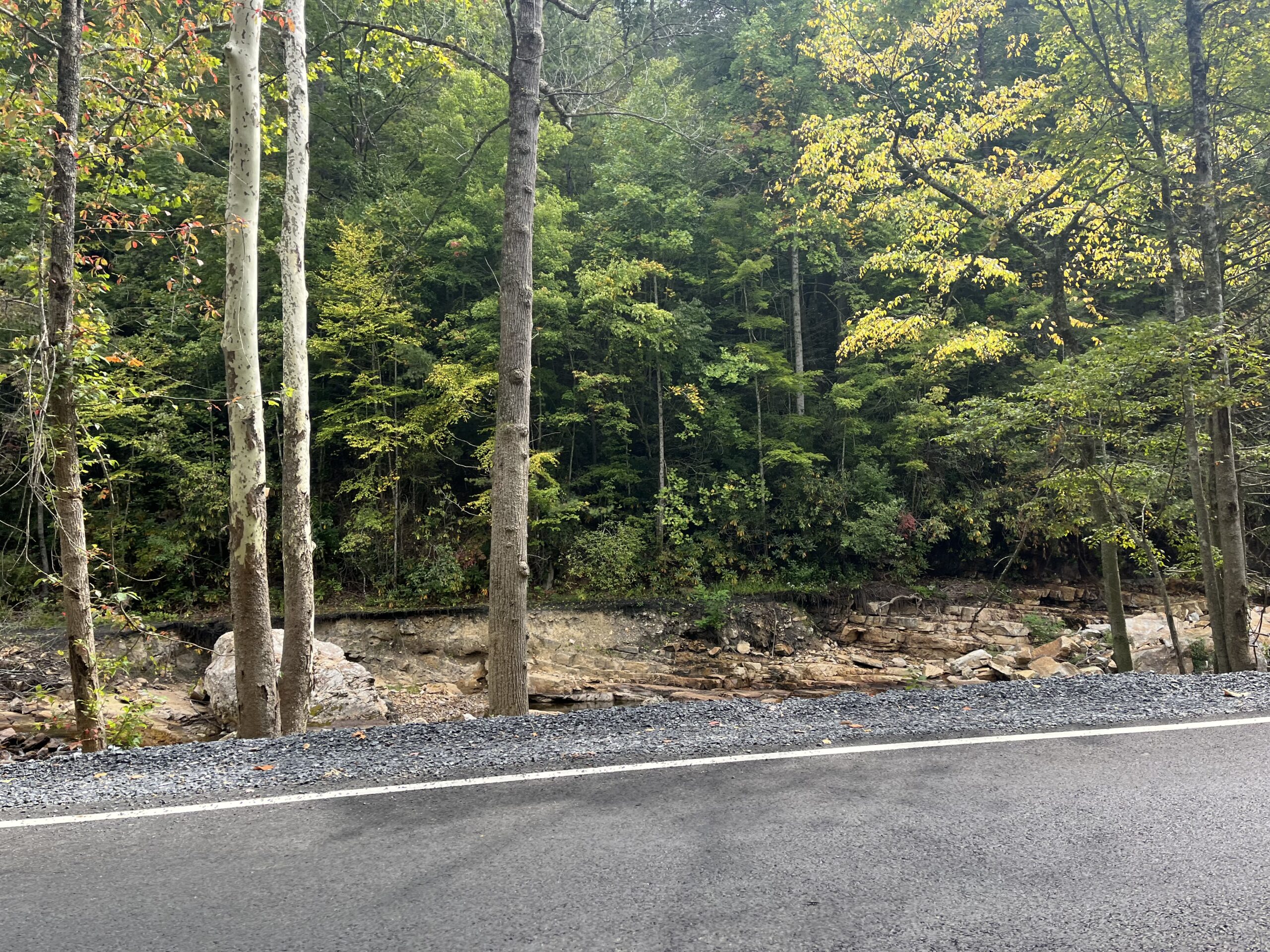
Extensive recovery efforts have already taken place in some parts of Grayson and surveying the county now, it could be difficult to tell that Helene ravaged the area only a year ago. But some spots remain permanently altered by the floodwaters.
“There’s areas that will never be back the way they were. There might have been 10 to15 feet of stream bank or river bank that’s just gone,” Spurlin said.
Fencing erected as part of voluntary conservation programs used to keep cattle out of waterways incurred some of the worst storm damage in the county. The fences would act as a net for debris coming down the streams but worsened flooding in some spots. Spurlin said new methods are being explored to help prevent that from being an issue in future storms.
“We’re actually looking at exploring the use of virtual fencing, being able to use GPS collars on livestock instead of having a physical structure along a stream bank,” Spurlin said.
To the west of Grayson County is the town of Damascus, is a key destination for many hikers and bikers who travel to the region.
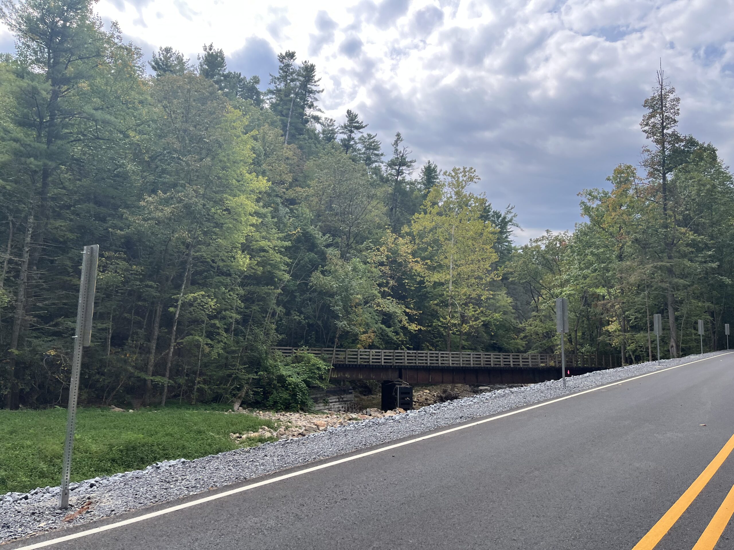
The popular Virginia Creeper Trail that stretches from White Top to Abingdon draws hundreds of bicyclists to Damascus to ride part of the trail. The most popular portion is the ride from White Top to Damascus – that was almost completely washed out in the storm. It is estimated that it will be at least another year before the trail is rebuilt. Route 58 was totally washed out from the Laurel Creek flooding in the town.
“It’s hard to believe on this beautiful afternoon that last year I was fishing, not on the creek behind me, but literally scooping fish off the asphalt of Route 58.” Damascus town manager Chris Bell said.
The Virginia Creeper Trail’s rebuild will cost an estimated $200-300 million and is projected to be completed in October 2026. Companies are bidding now for the chance to helm the project.
Damascus city leaders are using grant funding to create a flood mitigation plan to prevent future devastation. Bell said there was some work done along the Laurel Creek after a major flood in the 70s but not much was done for other vulnerable points along the water’s edge.
“Looking at bridge design, water flow, when they rebuild the Creeper Trail, when they’re rebuilding the bridge on Orchard Hill Road, those are the things the engineers are considering to allow water to flow and the water needs to flow,” Bell said.
In Damascus, 140 structures were damaged or destroyed – bringing an estimated $12 million in damages to residential properties, businesses and public facilities. Virginia endured an estimated $4 billion in damage and hundreds of thousands of cubic yards of debris were strewn across the region. Three people in Virginia died as a result of the storm, as well as over 250 people in other states.
The flooding in Damascus was, in part, due to debris building up on bridges and trestles that crossed the creeks. Once the weight was too much, the trestle or bridge would break, sending the onslaught of water and debris down stream. Bell said there is work being done to design new trestles that will allow better water flow,since they no longer have to support the weight of trains crossing over them.
The U.S. The Department of Agriculture is working with localities in the region to help restore the waterways that were impacted by the flooding.
“Several waterways near the Town of Damascus suffered major impairments. They ranged from complete waterway blockages due to cobble and woody debris to significant stream bank erosion. Following the storm, NRCS is working with 11 local governments, providing a total of $20 million in assistance through the Emergency Watershed Protection program,” said USDA spokesman Jefferey Blakly.
While Virginia did not see the level of mudslides that drastically changed its mountainsides, which did occur in North Carolina, there are still many changes on the local level that will require ingenuity, from rebuilding bridges to redesigning popular trails. Farmers are continuing repairs to their land and seeking new technology to better prepare for major storms on the horizon.
“Nature has a way of healing itself,” Spurlin said.


