
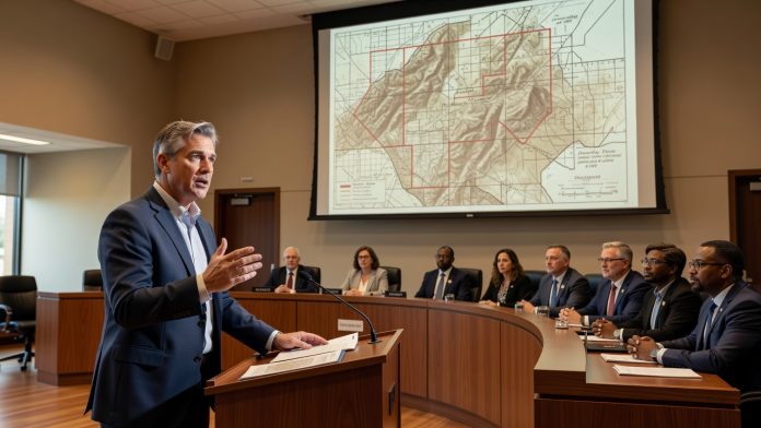
Loudoun County’s unique landscape doesn’t just happen by accident. Supervisor Caleb Kershner recently dug into the history of the Mountainside Overlay District, uncovering exactly how and why these land-use protections were established. The presentation occurred at a Loudoun County Board of Supervisors meeting. The board consists of Chair Phyllis Randall and eight district supervisors. These protections originated in the 1990s to address specific terrain features.
Establishment in the 1990s
The Mountainside Overlay District was created during the 1990s. It relied solely on a 700-foot elevation criterion for designation. This standard applied to slopes in Western Loudoun. Staff historians played a key role in developing the framework. The district incorporated multiple categories to differentiate levels of protection.
Western Loudoun’s slopes received particular attention due to their prominence. The elevation threshold provided a clear and measurable basis for the rules. Categories helped tailor restrictions to varying landscape conditions. This structure emerged from county planning efforts in that decade. The approach focused on the area’s distinctive topography.
Role of Historical Research
Historical review by county staff informed the district’s boundaries and guidelines. The 1990s initiative responded to growing development pressures in rural zones. Elevation data served as the primary determinant for inclusion. Western Loudoun benefited from these targeted measures. The resulting protections addressed environmental and scenic considerations.
Kershner detailed the process during the board session. The district’s design emphasized objective criteria over subjective assessments. Multiple categories allowed for nuanced application across the landscape. This method supported consistent enforcement over time. The history provides context for current land-use discussions.
Impact on Western Loudoun
The district has shaped development patterns in Western Loudoun since its inception. Slopes meeting the 700-foot standard fall under specific oversight. Categories within the district guide allowable activities on sensitive lands. The 1990s origins reflect responses to local geographic realities. Ongoing reference to this history aids in policy evaluation.
Board members reviewed the findings in the context of the county’s broader planning framework. The elevation-based system offered a straightforward implementation tool. Western Loudoun’s unique features remain central to the district’s purpose. Staff contributions ensured the rules aligned with available data from that era. The presentation added clarity to the district’s foundational elements.
Email the Loudoun County Board of Supervisors at:
Phyllis J. Randall (Chair, At-Large) – Phyllis.Randall@loudoun.gov,
Michael R. Turner (Vice Chair, Ashburn District) – Mike.Turner@loudoun.gov,
Juli E. Briskman (Algonkian District) – Juli.Briskman@loudoun.gov,
Sylvia R. Glass (Broad Run District) – Sylvia.Glass@loudoun.gov,
Caleb Kershner (Catoctin District) – caleb.kershner@loudoun.gov,
Matthew F. Letourneau (Dulles District) – Matt.Letourneau@loudoun.gov,
Kristen C. Umstattd (Leesburg District) – Kristen.Umstattd@loudoun.gov,
Laura A. TeKrony (Little River District) – Laura.TeKrony@loudoun.gov,
Koran Saines (Sterling District) – Koran.Saines@loudoun.gov